I am haunted by the underground rivers I see in historical maps of Manhattan.
I’m especially drawn to the mythic maze of subterranean streams under the East Village. These are left off the City’s public visualizations of the East Side Coastal Resiliency project (ESCR) project that is meant to protect our community from flooding. This is a potentially disastrous oversight that will affect my neighborhood as the sea level rises and climate change delivers increasingly intense storms.
Responding to my questions at public meetings, the Department of Environmental Protection says these subterranean streams are not under their jurisdiction, and they don’t know where they are. Why doesn’t the City have a Deputy Mayor for Infrastructure so agencies, adjacent projects and geography can be coordinated?
Look at some of the maps I’ve collected as background and inspiration for my work over the last 25 years. I map sustainable living resources including community gardens, greenmarkets, bicycling and solar sites. Since 2001, I’ve often included Manhattan’s historic shoreline to highlight how humans have impacted this “small island nation” and to foreshadow changes to come.
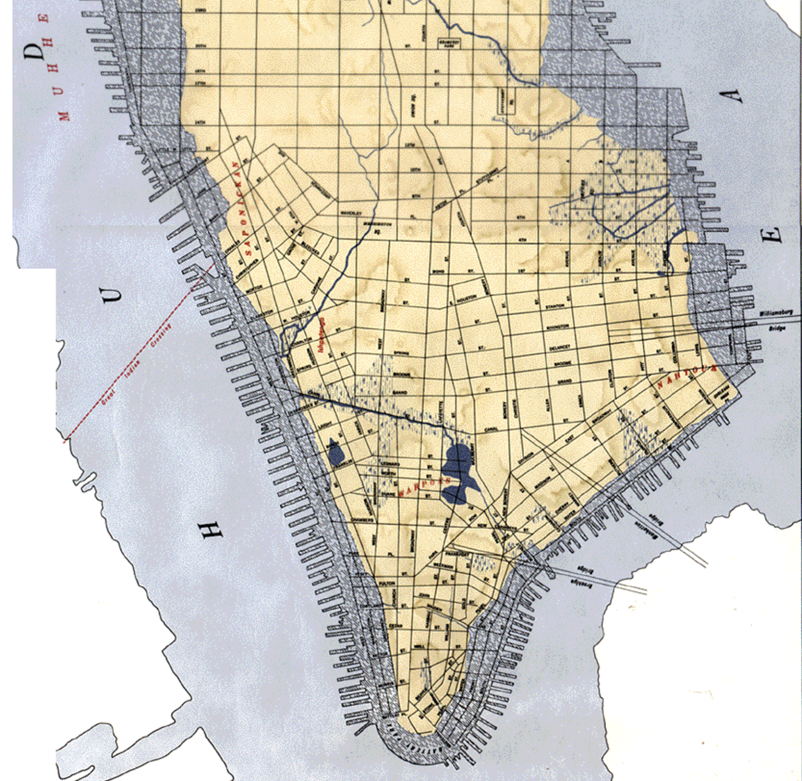
Townsend MacCoun’s map of Manhattan “at the time of its discovery” includes Native American villages (in red) and topography from 1609 with water-courses, marshes and shore line, overlaid with the 1867 street grid and harbor. Full of surprises, it was made for underpinning engineers, and still provides crucial knowledge for erecting new buildings and infrastructure.
In this map, the East Village looked especially vulnerable, with subterranean rivers and tidal salt marshes extending nearly to 1st Avenue. The book “The Archaeology of Home” tells how the land was extended and filled in, and how docks and shipyards soon ringed the shore. Even today, people in the community know that willow trees are indicators that these ancient waterways still flow. This year, test bores for rain gardens are being made in the same area for the Gardens Rising project, and there are reports on progress mapping the underground. Can’t these shed light for developing the ESCR, too?
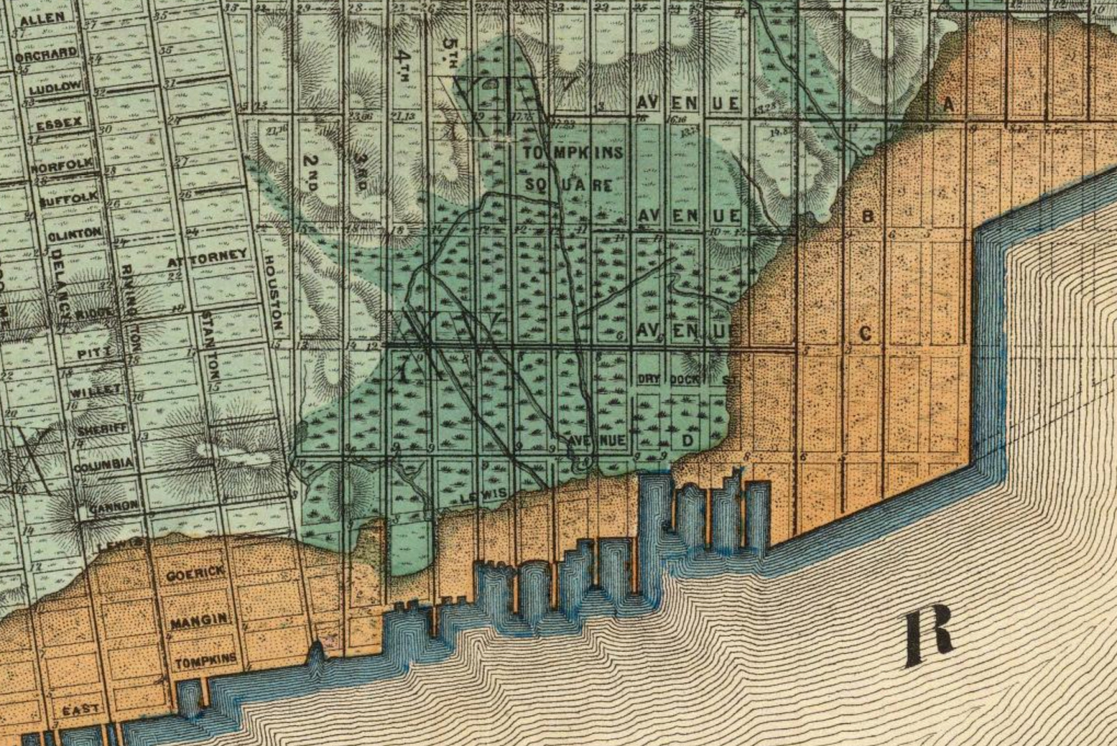
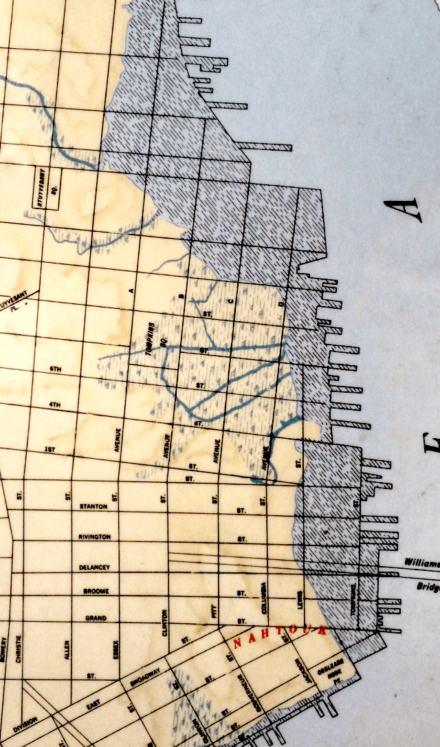
Check out the Viele Map, dated 1865. Use the link to see a zoomable version of the map with amazing details of the land under and around the 58 acres of today’s East River Park. The orange is landfill and piers, with the green being the extent of the original shoreline. Land and water continually transform one another. Climate change is accelerating that evolution. No one really knows what’s coming, or when. It’s clear though, that these maps provide information critical to the planning of the ESCR.
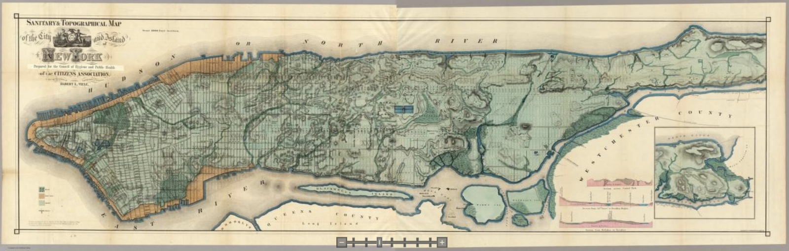
The Viele Map is properly known as the Sanitary & Topographical Map of the City and Island of New York. Use the slider at bottom center to zoom in and lay bare geographical vulnerabilities.
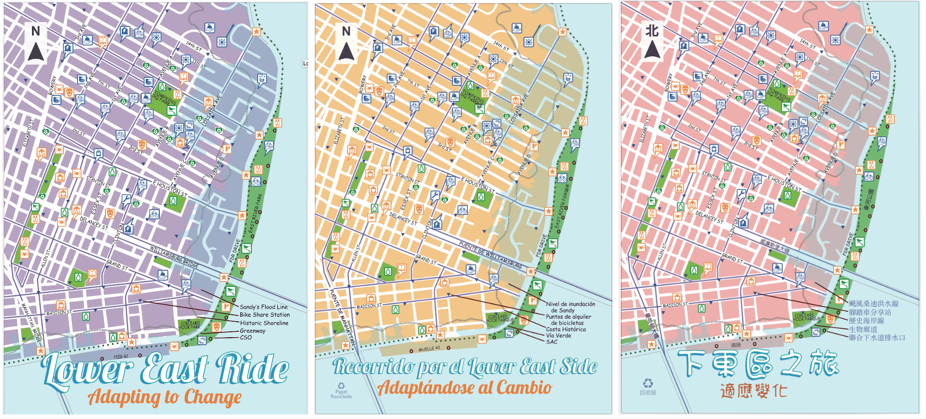
As a 30 year resident and as an individual active with the East River Alliance, I’m also sharing an example from my professional work with Green Map System. This post-Sandy view is the Adapting to Change, Lower East Ride edition. Produced in Spanish, Chinese and English in 2013, this small map promotes bicycling as an everyday climate change countermeasure. It includes both the super storm’s high water mark and the original shoreline, as well as the combined sewer outfalls in East River Park, the then new bike share stations, bike lane network, etc.
The next map I make will include the subterranean streams that still run under the community. As major changes to the geography are being prepared, I ask the City, will your ESCR plans include them, as well?
– Wendy Brawer

One Reply to “”